Clowne - Creswell Walk
Recording, conserving and promoting the landscape and rocks of the Sheffield region
Clowne - Creswell Geo Trail
This walk explores geological events of the Upper Carboniferous and Permian periods, from approx. 310 to 250 million years ago.
The walk is centred between two locations, along well maintained footpaths, with car parks at both locations, but can be walked or cycled in a day.
The first location is at Clowne, where the exposures are of the basal Permian Rotleigendes Formation and the overlying Wetherby Member of the Cadeby Formation of dolomitic limestones (called dolostones). There is a bonus of a rare Carboniferous coal seam exposure, below the Permian unconformity. Allow about two to two and a half hours for the return walk on this section.
The second location is at Creswell Crags, to the east, where the upper part of the Cadeby Formation, the Sprotborough Member, is well exposed.
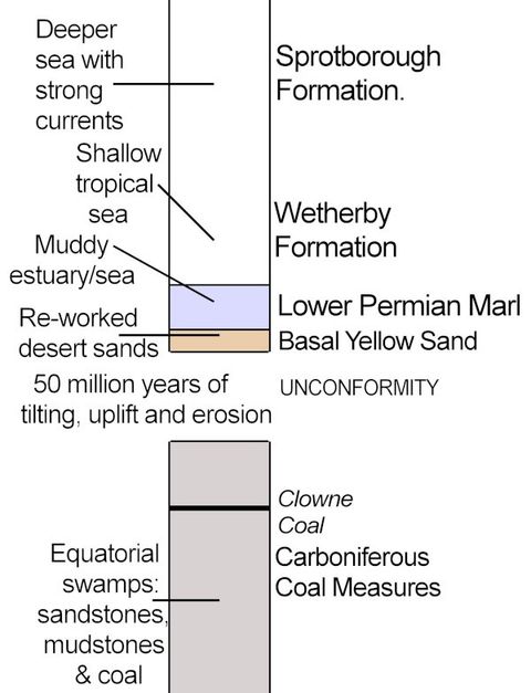
Fig 1: A labelled sketch geological column (not to scale) for the Clowne Creswell Crags Geo Trail
(Image: Rick Ramsdale)
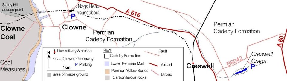
Fig 2: Map of the Clowne Greenway - Creswell Crags geo trail. This figure has been drawn using OS and BGS information.(Image: Rick Ramsdale)
The Clowne Branch Line Greenway
This Greenway track (an old railway trackbed) runs west from Clowne to Markham Vale, and was restored between 2017 and 2020 but has not yet been extended eastwards, less than 3km to Creswell. It is hoped that funding will be found to achieve this in the near future. It is possible to complete this two locations trail by car, cycle, or on foot. The newly completed Greenway is relatively clear of vegetation, but this will soon grow back. If you want the
best view of the geology, go soon, or go in winter.
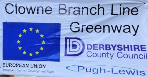
Fig 3: Clowne Branch Line Greenway sign.
(Image: Rick Ramsdale)
page under construction
