SAGT News 2022
Quarries near Wentworth - posted 26 September 2022
Two old quarries on the edge of the Wentworth Estate have proved their worth after some years of being by-passed. Recently, Duncan Hawley, went to survey the site, which was designated a Regionally Important Geological Site by the original SAGT area survey back in the late 1970. There was no record of it having been visited since then, and Duncan arrived on site not knowing if the old quarries still existed or if they had been filled in.
Fortunately rock exposure is still present, although the condition is not ideal to see the geology clearly. However, he did manage to examine the rocks and gather enough evidence to indicate that the rocks would repay further, more detailed study. These quarries are important because they are the only known exposure of rocks in the Rotherham district that lie between the Flockton Thin and the Flockton Thick coal seams (Upper Carboniferous, Lower Coal Measures, Westphalian Stage, Langsettian Substage, approx. 319-318 Ma BP).
Other records are from old sub-surface boreholes or sites now covered that cannot be verified The sediments are mainly medium-grained laminated sandstones with ripple-cross lamination sets and parting surfaces are frequently scattered with black, coalified plant matter, with some poorly preserved impressions of fossil trees.
The rocks are interpreted as being formed by a large meandering river breaching its levée banks and spilling onto the adjacent floodplain as a either a crevasse splay, or, as a small delta into a floodplain lake. At present, there is some uncertainty as to which of these geological scenarios is the more accurate. The quarry exposures provide evidence to interpret and test the hypotheses about the geological environment as it was in the Rotherham district in the period of Carboniferous Coal Measures between the formation of the Flockton Coals. In turn, study of the Shepherd’s Plantation exposures place the geological history of the district more accurately within the wider regional context of the Coal Measures. As such, these exposures are important to scientific study and are regionally significant.
It is not clear at what dates the quarries were worked. In 1850 they were surveyed by the Ordnance Survey as ‘Sandstone Quarries’, but in the re-survey of 1890 they are marked as ‘Old Quarries’. The quarries and exposure are in relatively poor condition, with the old quarry faces gradually being smothered in leaf litter, covered with tree saplings or threatened by rubbish infill. However with some conservation effort they could be brought back into reasonable condition. The ‘rediscovery’ of the old quarries was undertaken as part of a RIGS condition monitoring survey contract with Rotherham Borough Council.
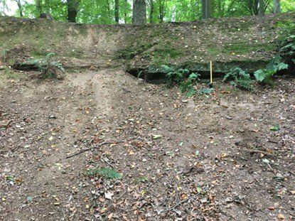
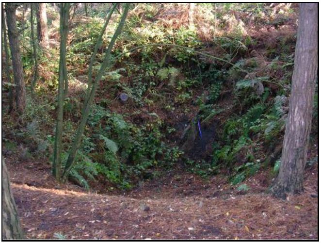
Quarry A, exposing about 0.5m of rock. Digging the soil and leaf litter talus slope below reveals more of the original quarry face.
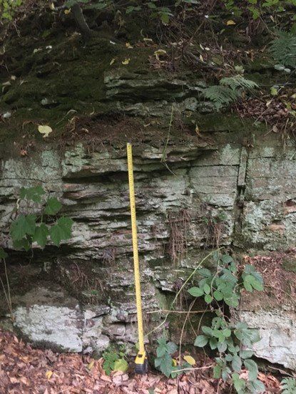
Quarry B. The exposure is better in this quarry, showing a series of stacked ‘flaggy’ sandstones
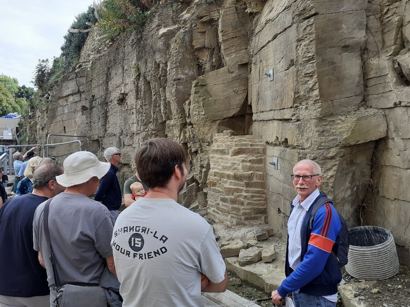
Geological tour of the Sheffield General Cemetery - 17 September 2022
A SAGT member led a group of 20 people around parts of the General Cemetery (off Ecclesall Road), as one of the Cemetery Trust’s activities for Heritage Week on 17th September. The tour started with a look at the geological maps of the area, demonstrating the overall structure of the beds which underlie the Cemetery, and where the local sandstone cropped out, giving rise to an old quarry, now lost. An explanation of the main groups of rocks, sedimentary, igneous and metamorphic, was helped by a large display board with actual samples fixed to it – all of which can be found in the gravestones or buildings on the site. At the Gatehouse are three large blocks of tough igneous rocks, showing the ‘plug and feather’ marks left by the process of extracting and shaping them.
At present, much of the area is a giant building site, as stabilisation works are being carried out on the catacombs, which have been gradually slipping downhill, and as some of the listed tombs are renovated. The tops of the pre-War grave plots above the catacombs have been exposed to the air whilst work is carried out, although these were never used for burials.
Rock types were identified during the tour and aspects of weathering were explained, resulting in most people agreeing that marble is not a good choice in the Sheffield area, as it soon weathers from shiny white to dirty grey. The visit was enhanced by a doctor explaining some of the childhood diseases which had carried off so many infants in the Victorian period. Further enhancement was supplied at the Samuel Worth Chapel, where cuppas and buns were waiting for the group!
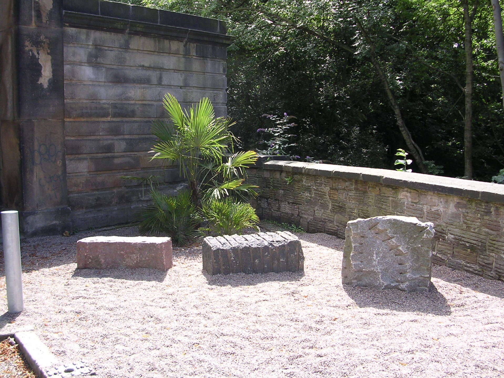
Igneous rocks at the Gatehouse. Photo - P. Kennett
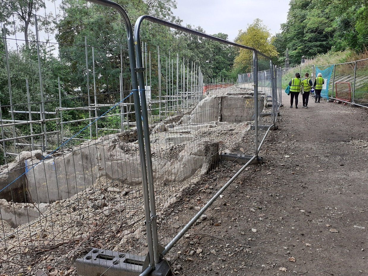
Concrete grave plots stripped off during renovation work, Summer 2022. Photo - P. Kennett
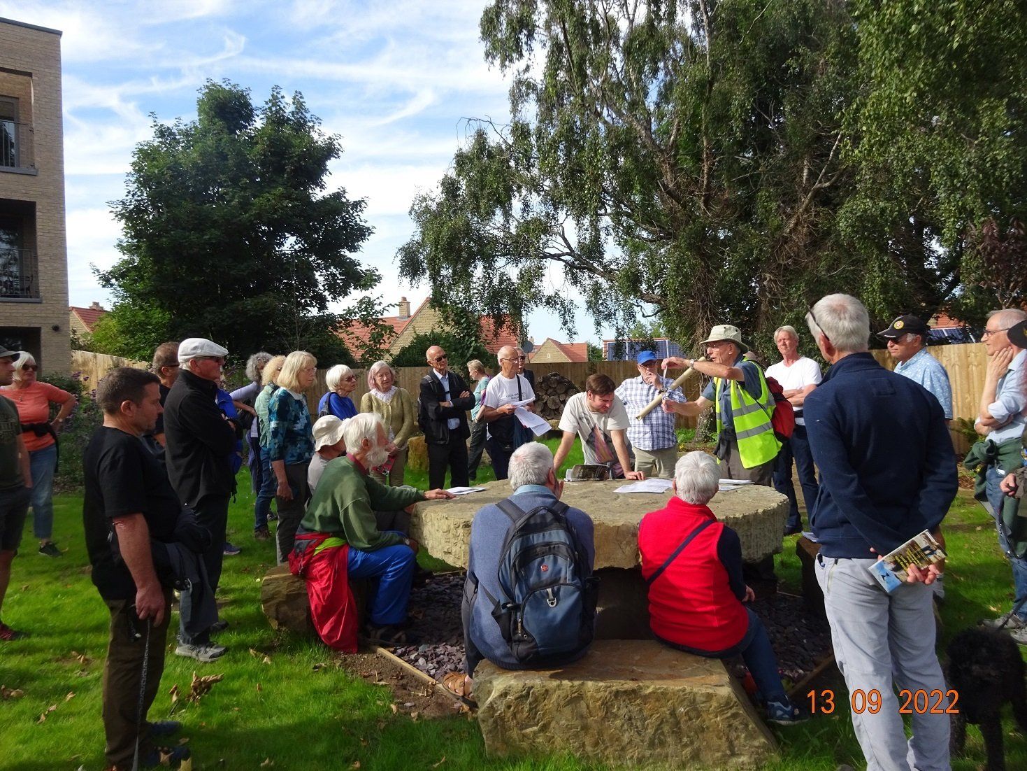
Nether Edge Festival - 13 September 2022
Three SAGT members led a group of 35 adults, two babies, two dogs and two bikes around parts of Nether Edge on 13th September, starting on Brincliffe Edge Road. How many people stop to think about the geology under their feet, its influence on the physical landscape and its economic importance, especially when most of the area now consists of housing? Prompted by a large panoramic photograph, taken from Homebase on the Chesterfield Road, visitors were enabled to appreciate the scarp slope and dip slope created by the resistant Greenmoor Rock, on which they were standing. The direction of dip could be inferred from the landscape and this was later confirmed by an actual measurement of the dip at a roadside exposure on Quarry Lane.
The route led along Chelsea Road and into the grounds of the apartment blocks now being constructed on the floor of the old quarry, formerly occupied by the Omega Restaurant. The leaders had been able to visit the site when the groundwork was being carried out and could match up photos of that stage with the new blocks. Some of the building work is based on piles driven down through about 6 metres of inert landfill, placed there many years ago, but elsewhere fresh stone had been quarried to provide a level platform on solid rock. Some of the resultant large blocks have been used to create a recreation space open to the public and visitors were able to examine small scale sedimentary structures and the nature of the weathering in the blocks. At this locality, the Greenmoor Rock is known as the Brincliffe Edge sandstone and the ‘Brincliffe Blue’ variety was highly prized for grindstones for the cutlery industry. Most of the stone has weathered to brown tones, but was just as valuable for building stone, stone flags and gravestones.
Two of the leaders are engineering geologists, so discussion of the measures taken to stabilise the rock faces adjacent to the buildings came to the fore.
The walk ended at the cliff face behind the Co-op on Ecclesall Road, where passers-by are protected from rock falls by a concrete wall and a substantial wire fence. Most of the rock here consists of siltstones, which were used to make bricks until the post-War period, but there are sandstone units, one of which displays a normal fault with throw of about 3 metres, although this is best visited in winter when the foliage has died down. An attempt was made to model this in a plastic box with sand and flour, which was only partially successful on this occasion!
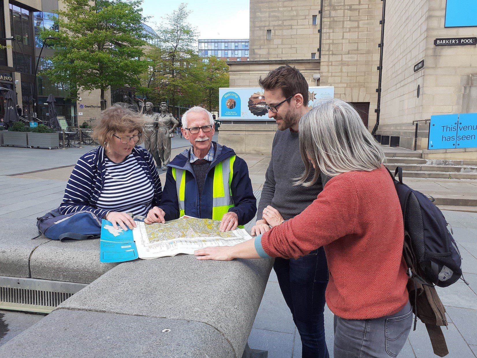
The building stones of Sheffield - Guided walk - 10 May 2022
Discussing slope stability measures in the old “Omega” quarry, Photo - P. Kennett
Sedimentary structures and quarrying history at the public space in the former “Omega” quarry. The large blocks of the Brinclifffe Edge Rock were extracted during foundation work for the apartments.
Photo - J. Cripps
The picture was taken at the start of yesterday's geology walk which was an SAGT contribution to Geo-Week and Sheffield Environment Weeks. It was led by John Cripps and Peter Kennett who showed a small, but enthusiastic group the great wealth of geology that is present in Sheffield City centre where pavements, street furniture, buildings and monuments are constructed from a wide range of rock types derived from the local area and imported from distant parts of the world. Some fossilised wood was discovered and participants were surprised by damage caused by ill-advised attempts to clean the stone of some shop fronts.
Mine shafts at Ringinglow - April 2022
A dog was rescued from a mineshaft, in late April 2022, close to Ringinglow Road, in rough land beside Lady Canning’s Plantation. This appears to be a shaft which was not shown on the BGS 1:10560 map of 1962. The shafts were mapped in the 1860s when depths to the Ringinglow Coal were reported by the miners at that time.
The coal seam at Ringinglow was worked from at least the 18th Century onwards, partly for the coal itself, but also for its relatively high content of pyrite (FeS2), which was used to make copperas (ferrous sulphate) for use in the textile industry. The main workings of the “Ringinglow Colliery” were in the Limb Valley and the seam was worked by drift mines in the banks of the stream. The colliery was closed in 1912.
The shafts 1 to 5 on the map were seemingly active in the mid 19th Century.
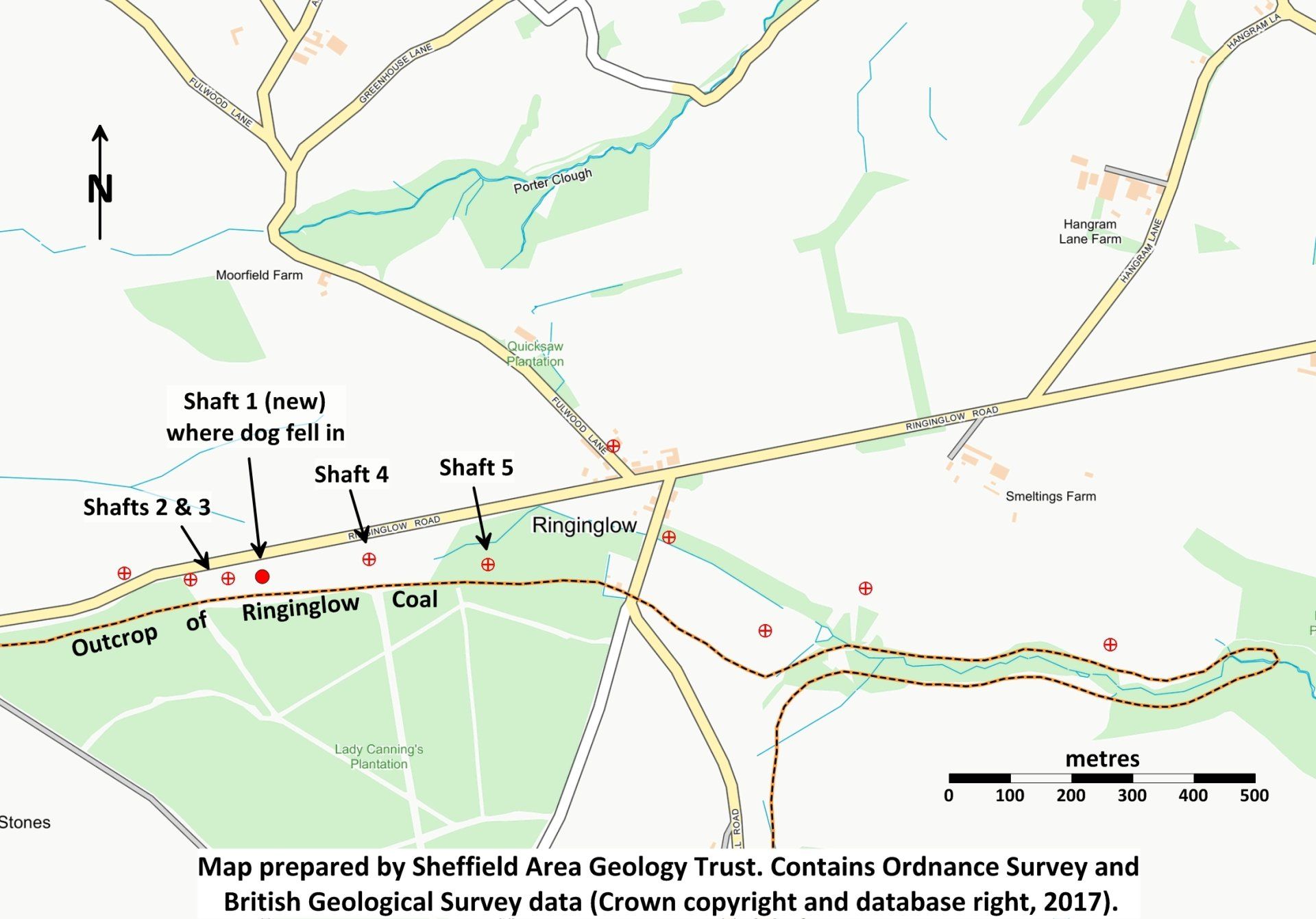
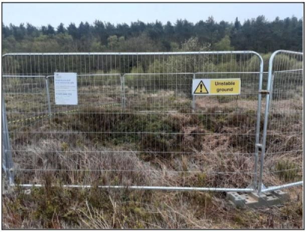
Shaft 1 at SK2842 8358 with Coal Authority fencing
Shaft 1 seen through fencing. Shaft is about 2.5m across and appears to be in shales
with very clean sides, suggesting recent collapse, not 150 years of slipping.
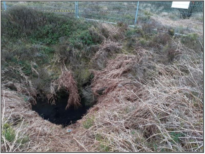
Shaft 2 at SK2938 8357, flooded with tangled tree roots.
BGS map states 54 feet to Ringinglow Coal
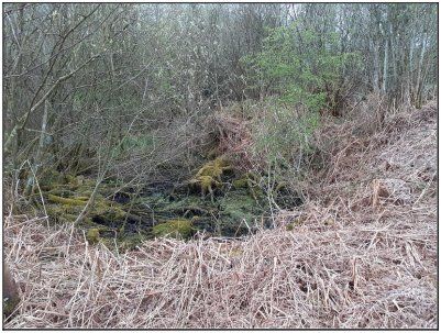
Shaft 3 at SK2832 8356, flooded.
Ringinglow Road in background

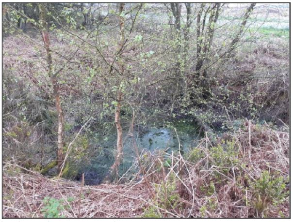
Shaft 4 at SK2863 8360, adjacent to rough layby, with associated rubbish.
BGS map states 48 feet to coal seam
Shaft 5 at SK2880 8358 in Lady Canning’s Plantation (in 2005)
